Delivering Comprehensive Spatial Solutions
Tech Mahindra offers end-to-end geospatial services integrating the entire data value chain from capture to reporting. Our advanced workflows ensure high-precision data acquisition and processing, empowering organizations to visualize geospatial intelligence, conduct in-depth analysis, and generate actionable reports.
Our Services
Tech Mahindra’s comprehensive spatial solutions are designed to solve real-world challenges and generate opportunities. Our scalable, high-speed innovations in spatial technology help businesses create a more connected world.
Street View Data Collection, Spatial Data Capture, Data Management, Data Analysis, and Data Visualization
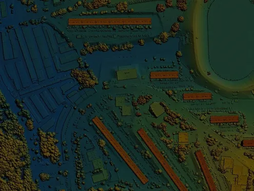
TechM GIS Spatial Services harnesses the power of spatial data with advanced solutions such as LiDAR, high-resolution, and panoramic imagery. These technologies provide precise, multidimensional insights that enhance design, maintenance, and operations. Our geospatial solutions empower organizations to make data-driven decisions and drive sustainable growth across industries by integrating detailed imaging with comprehensive data collection and analysis.
Field Service Management, Operational Planning, Scenario Modelling, Demand & Supply Forecasting and Workforce Optimization
Yantr.ai is a cognitive platform enabled by machine learning and cutting-edge process design. It delivers actionable insights and recommendations for the planning team and manages on-ground field engineers.
Altavec AIMS Clearance: Asset Management, Asset Inspection, Defect Detection, AI/ML, Network Resilience, Risk Mitigation, Hazard Management, Spatial Data Visualization, Data Management and Analysis
The Altavec AIMS Clearance harnesses machine learning to automate the detection of assets and defects, streamlining inspection processes and enhancing accuracy.
Altavec AIMS 3D: Asset Management, Asset Inspection, Digital Model, Digital Twin, AI/ML, Network Resilience, Risk Mitigation, Hazard Management, Spatial Data Visualization, Network Design, Data Management and Analysis
AIMS 3D offers immersive 3D visualization capabilities for LiDAR and imagery data, allowing for better planning, design, and simulation activities.
Altavec AIMS VAA: Asset Management, Asset Assessment, Defect Detection, AI/ML, Network Resilience, Risk Mitigation, Hazard Management, Spatial Data Visualization, Data Management and Analysis
AIMS VAA is an optimized virtual assessment tool that provides data-driven insights into asset conditions, ultimately leading to more efficient maintenance practices.
Altavec Field Mobile Computing (FMC): Field Mobilization, Asset Inspection, Asset Management, Meter Reading
FMC streamlines asset inspections by enabling task creation, assignment, completion, and reporting. Field users complete inspections via the mobile app, synchronizing results for seamless desktop access and management.
Altavec AIMS Zero: Risk & Hazard Management and Lone Worker Safety
AIMS Zero functions as a proactive safety companion for field workers, utilizing technology to identify and alert workers to potential hazards, ensuring their safety while on the job.
Industries we serve
Leading the Way
Thought Leadership
Get In Touch
Need more information?
We will take approximately 3-5 working days to respond to your enquiry.


